Discover Your Ancestors
Two critically acclaimed publications are available to family history researchers - the annual print magazine, Discover Your Ancestors, and the monthly online magazine, Discover Your Ancestors Periodical. Click here to subscribe.New Searchable War Memorials

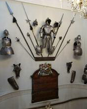
A war memorial recording Liverymen and Freemen of the Worshipful Company of Armourers and Brasiers
TheGenealogist has just released over 12,000 records from 138 war memorials. This means that there are now a total of over 580,000 individuals listed on war memorials that are fully searchable in TheGenealogist’s Military Records collection, with photographs centred on their inscription. These memorials can give researchers an insight into the education, rank, regiment and occupation of an ancestor.
The Map Explorer on TheGenealogist can also be used to locate all the war memorials on georeferenced historic and modern maps, making them easy to find. The war memorial database includes names from the Boer War, the First World War and the Second World War. This latest release from TheGenealogist covers war memorials from various parts of the UK, particularly West Yorkshire, County Durham and East Sussex, as well as Canada.
This new release covers memorials that are not all set in stone or cast in iron. For example, there is the WW1 memorial volume book held in Darlington Central Library for Pease and Partners of Darlington. This firm owned mines, quarries and other works all over County Durham and Teesside. This particular memorial is useful to a researcher wanting to break down ‘brick walls’ as it not only gives the rank and regiment of the man, but also gives his place of occupation (which particular mine, quarry, or works they had been employed in), which could aid a researcher to try to get the employment record for an ancestor – the volume is divided into sections for the 543 men who died, over 4,100 who served and details of the medals awarded to 134 of them.
Other employment war memorials in this release include: the Yorks & Lancs Railway locomotive works at Horwich, where 122 employees were killed in WW1, and in London the Worshipful Company of Armourers and Braziers, recording 37 men who were killed or served in WW1 and WW2. Additional school and college war memorials added this time include Petworth Boys school, which commemorates two teachers and 28 pupils killed in 1942 when the school was destroyed by enemy action, and King’s College Cambridge where 345 students or former students etc. are commemorated.
More enhancements for groundbreaking online Map Explorer tool are released
TheGenealogist’s latest innovation to help you find an ancestor’s property and watch the landscape change over time has now been enhanced by the addition of georeferenced colour tithe maps. TheGenealogist has also just released colour tithe maps for Cumberland – you can search these as normal or browse them on Map Explorer.
Joining the georeferenced Lloyd George Domesday Survey data layer, plus headstones and war memorials, the colour tithe maps are a significant addition to the ever-expanding Map Explorer.
TheGenealogist has linked these highly detailed tithe maps to the apportionment books, which provide researchers with the details of the plots, their owners and their occupiers at the time that the survey was taken in Victorian times, from large estate owners to occupiers of small plots such as a homestead or a cottage. These make the maps easier to understand as the streams, rivers, lakes, ponds, houses and trees are often highlighted in different colours.
These colour maps now cover the counties of Warwickshire, Rutland, Huntingdonshire, Buckinghamshire, Middlesex, Northumberland, Surrey, Westmorland, the City, North and East Ridings of Yorkshire along with the newly launched Cumberland.