Discover Your Ancestors
Two critically acclaimed publications are available to family history researchers - the annual print magazine, Discover Your Ancestors, and the monthly online magazine, Discover Your Ancestors Periodical. Click here to subscribe.New update to innovative map tool

TheGenealogist’s latest innovation, the Map Explorer, launched recently to help you find an ancestor’s property and watch the landscape change over time, has now had its first powerful new features added. Further enhancements are coming soon.
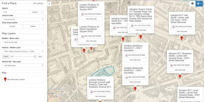
Joining the georeferenced Lloyd George Data layer now are headstones and war memorials, with links to see photographs, transcripts and setting for the latter.
Once you have found an ancestor’s grave or memorial, you will now not only be able to see an image of it and read a transcript, but also see exactly where it is in relation to towns, villages or cities on the historic or modern maps. This should make it easier for family historians to plan a visit to see where an ancestor is buried or commemorated.
TheGenealogist’s powerful Map Explorer has been developed to view these georeferenced historic maps overlaid on top of modern background maps including those from Ordnance Survey and Bing Street maps, as well as a satellite view. With the Map Explorer you can search for an ancestor’s property, discovering its site, even if the road has changed or is no longer there.