Discover Your Ancestors
Two critically acclaimed publications are available to family history researchers - the annual print magazine, Discover Your Ancestors, and the monthly online magazine, Discover Your Ancestors Periodical. Click here to subscribe. Plotting the past
The first national collection of online tithe maps has started to be released, thanks to TheGenealogist.co.uk
It's always been a challenge to find where our ancestors lived, but newly online records can help you explore the fields and houses in their home villages and towns. Never before have family historians been able to search nationwide for the uniquely detailed resource of tithe maps.
Last year, in partnership with The National Archives, data website TheGenealogist.co.uk made it possible for family history researchers to search more than 11 million original tithe apportionment records from across England and Wales in the early part of Queen Victoria's reign. Now the site has begun to release linked maps, which offer incredible detail on land holding at the time.
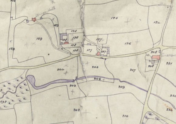
Tithe maps allow you to pinpoint your ancestors precisely. They show the boundaries of fields, woods, roads, rivers and the location and shape of buildings. The detail recorded within the maps and associated apportionment records will show you how much land they owned or occupied, where exactly in the parish it was, what the land was used for and how much tithe rent there was to pay.
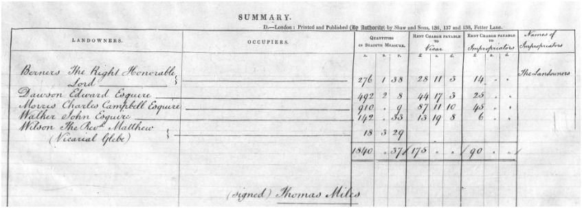
Tithes, originally one-tenth of the produce of the land, were paid to the Church and, after the Reformation, to some lay tithe owners as well. These 'lay impropriators' were often landowners who gained the rights to the tithe rent payments on the redistribution of monastery lands in Henry VIII's time. When this land appears in the 19th century records, then the sums payable to the successor landholders will be listed within the apportionment records, so you may find that one portion of rent was destined to go to the vicar and another sum to a non-ecclesiastical landowner.
In the example below the landowner, Lord Berners, is also the lay impropriator and so, in theory at least, he paid himself as well as the vicar!

Lord Berners in the Tithe Records at TheGenealogist
The Tithes Commutation Act of 1836 finally abolished payments of 'goods in kind' and instituted a plain fixed annual monetary payment based on the land value. The aim of the government was that, over time and with inflation, this tithe payment would diminish to nothing but a mere token amount. But first the government had to discover the value of the land holdings across the country so that it could carry out its plan. To do this a grand survey was undertaken and the result was the tithe apportionment records and their accompanying maps.
As soon as the Act of Parliament was passed, the surveying started. Taking about 15 years to carry out, the first completed tithe maps and apportionments appeared from 1837.
Three copies of the tithe records were made. One would have been sent to the parish to be kept safely, but in most cases the accompanying maps were so large that they would not fit in the parish chest. They ended up stored elsewhere in the church, even propped up against a wall, so many were lost or damaged.
The second went to the Church of England diocese with authority over the parish, and the third set of tithe apportionments and maps was sent to the Tithe Commissioners in London.
This is why copies from the whole of the country are now housed in The National Archives (TNA) and it is these that are now available to search at TheGenealogist.
Due to their age and the materials used the original maps are often too fragile to handle. These were microfilmed in 1982. The first stage of the project is the release of these as online images. There are over 12,000 main maps plus thousands of update maps as the boundaries of fields changed over time.
The second stage will be the delicate conservation and digitisation of the original colour maps.
"Tithe records are a rich resource for family historians as they cover owners and occupiers of land from all strata of early Victorian society," says Mark Bayley, Head of Online Content at TheGenealogist. "These maps can be three to four meters in length by several meters in width and have gone through multiple levels of digitisation and processing so that the huge maps can load instantly, even on a mobile phone. This fantastic resource was created as a result of one of the largest surveys into the usage, ownership and occupation of land in England and Wales since the Domesday book".
Diamond subscribers to TheGenealogist are able to view apportionment records for all of England and Wales, with the accompanying maps now being live for Middlesex, Surrey, Buckinghamshire and Leicestershire. The maps for the rest of England and Wales will follow over the coming months.
See TheGenealogist.co.uk/Tithe to freely search the records and learn more about them.
Using the Records
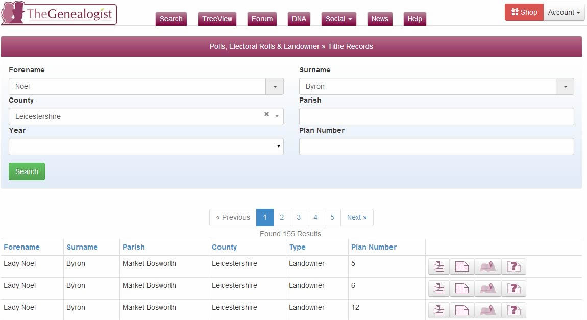
Let us do a search for the Leicestershire landowner, Lady Noel Byron, the former wife of the poet Lord Byron. We find that she has large holdings in the country at the time of the survey.
We are then able to look at one of the holdings to see the record for some land occupied by a Thomas Godfrey. To see the tithe apportionment requires only a single click and this image of the page reveals the amount of rent payable, in this case, to the Rector alone. The apportionment gives us the measurement in acres, roods and perches and the value of the tithe payable to the Rector. Infuriatingly, the size of these units of measurement could vary according to the locality that they were applied.
From this record, for the land in question, we gain the name and description given to it, what use each parcel was put to in the "State of Cultivation" and can also take notice of the fact that Thomas occupied other plots as well.
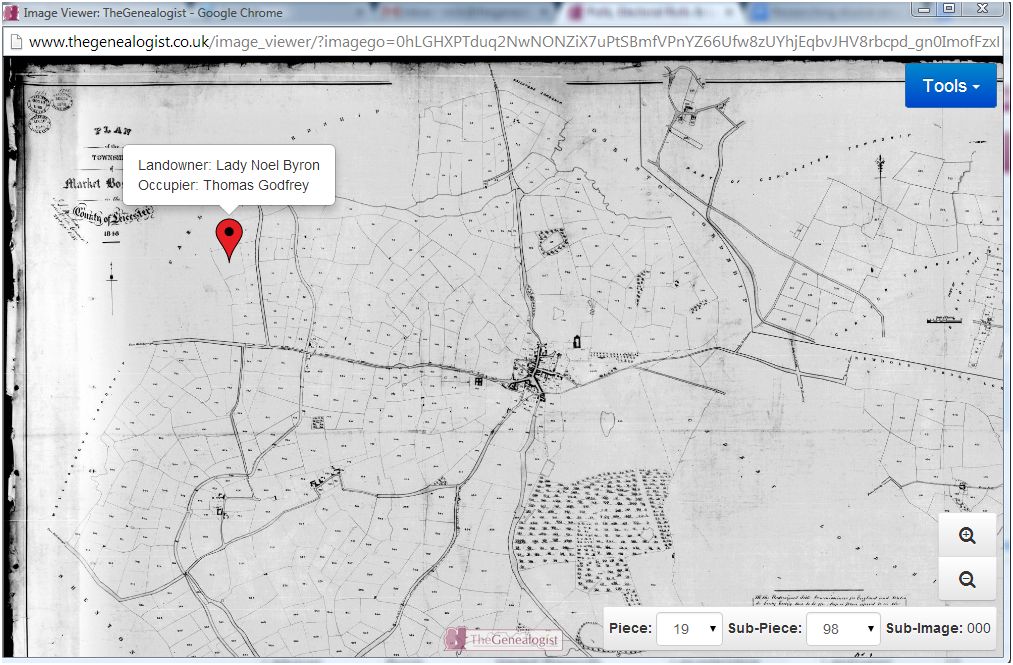
One click shows us exactly where the holding is situated on the plan for the area with a pin on the map giving us the names of the landowner and the occupier.


